Charlotte Region Braces for Cooler Temperatures Amidst Stormy Weather
The Charlotte region is experiencing a shift in weather with rain and storms expected, including a risk of severe thunderstorms on Tuesday. This rainfall is bringing significantly cooler temperatures, with highs forecast in the upper 60s for Wednesday and Thursday,…

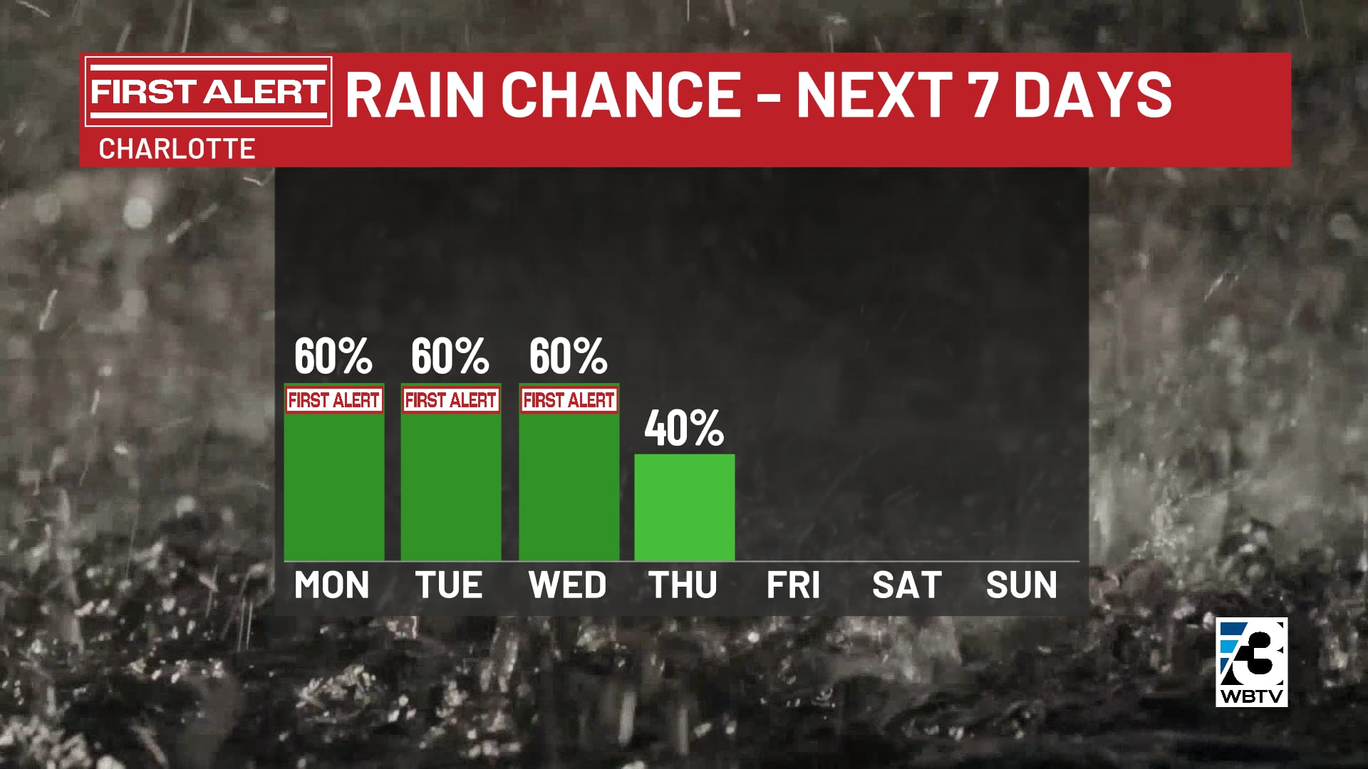
 Charlotte, NC, September 22, 2026 — The Charlotte region is set to experience a notable shift in atmospheric conditions as a period of rain and storms approaches, bringing with it a significant cooldown. Forecasters are issuing warnings of potential severe thunderstorms expected on Tuesday.
Following the anticipated storm activity, the region will see a substantial drop in temperatures. Highs are forecast to hover in the upper 60s on both Wednesday and Thursday. This marks a return to cooler weather not seen in the area since the conclusion of the Memorial Day weekend.
The incoming weather pattern is characterized by expected rainfall and ongoing storm systems. Residents and local authorities are advised to monitor weather updates, particularly concerning the severe thunderstorm risk anticipated for Tuesday. The duration of this cooler spell remains a point of interest as the week progresses.
This transition signifies a departure from warmer conditions, with the upcoming upper 60s Fahrenheit presenting the coolest temperatures recorded since the unofficial start of summer. The full impact of the storms and the longevity of the cooler temperatures are expected to become clearer in the coming days.
Specific details regarding the intensity or duration of Tuesday’s severe thunderstorms were not provided. Similarly, forecasts beyond Thursday were not detailed in the available information, leaving the extended outlook for the region’s weather subject to ongoing meteorological analysis.
The cooling trend is a direct consequence of the expected precipitation and associated weather systems moving into the area. This change is anticipated to be a significant departure from recent weather patterns, offering a respite from warmer conditions.
Story summarized from the original created by Paul Heggen on www.wbtv.com, see more information here.
Media gallery